Recreation in the
Mountain Pine Ridge Forest ReserveThe Mountain Pine Ridge Forest Reserve in south central Belize is a unique ecosystem in the region and has an area of 43,333 hectares (107,078 acres). Located in the Cayo District, the MPRFR is with a tropical climate and is at an altitude of 350 m to 980 m.a.s.l.. The MPRFR is bordered by protected areas, except for the northeast corner that borders the private properties, Hidden Valley and Bull Run and the north western corner is bordered by the Enclave. To the north of the Baldy Beacon Road on the northeast east corner, several other private properties border the MPRFR.
The Reserve is covered with Pinus caribaea var. hondurensis and P. patula ssp. tecunumani which are endemic to the area. Patches of hardwood thrive throughout the pine forest and the riparian hardwood gallery forests run along the numerous creeks traversing the pine savannah. These waterways give rise to a few refreshing pools, ideal for swimming and other recreational activities within the reserve.
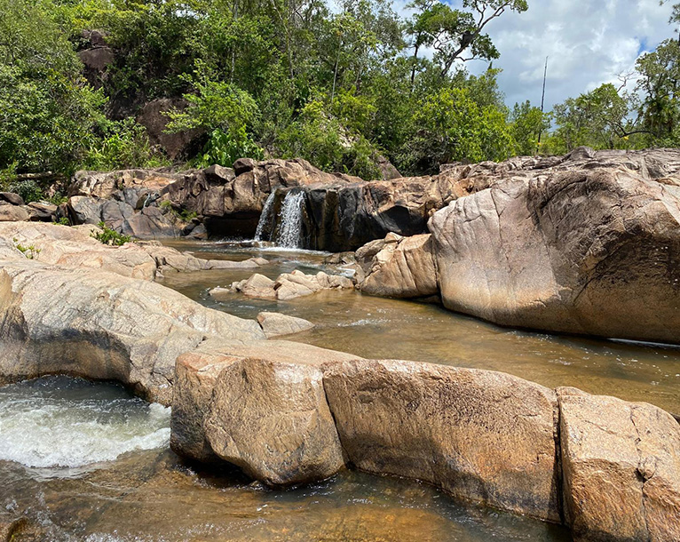
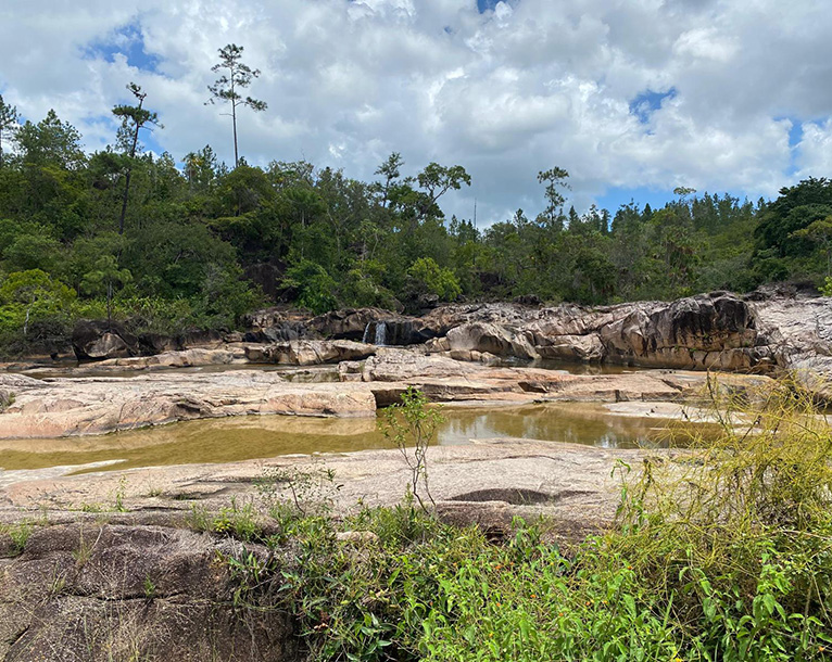
Rio on Pools
Rio On, a sub catchment of the Macal River, was formed when the soil layers, so thin, was swept away by flood, leaving one of the largest exposed granite riverbeds in the Mountain Pine Ridge Forest Reserve (MPRFR). The riparian forest on either side helps, to hold the remaining soils in place. Because of the wide expanse of granite heated daily by the sun, there are few blackflies and large pools formed are good for swimming, offering cold water to cool off on hot days and sun-baked rocks to lie on and warm up if the water becomes too cold.
The pools contain many marine toad tadpoles (tiny black ones) and larger Leopard frog tadpoles. Fish found in the pools include mosquitos’ fish, Central Tetras, Guatemalan Chulin (small carfishes) and Mexican Green Swordtrails. Being open to the full sun, the rock surfaces beneath the water are covered with algae, diatoms and other micro-producers enriching food resources available to todpoles and fish.
The many small pools formed in the rock, often carved by small rocks, pebbles and sand swirling around in depressions during high flow, over thousands of years. These pools drastically change temperature through the day, becoming very warm during mid-day and cold at night. A variety of small creatures are adapted to living in these pools, including midge larvae, diving beetles, seed shrimps and marine toad larvae (Dr. Ed Boles, 2020).
Rio Frio Cave Complex – The Rio Frio Cave Region encompasses:
-
- Twin Caves (Rio Frio Caves A and B),
- Rio Frio Cave (C)
- Rio Frio Caves D and E.
- Closing Jaw Cave
- Tunel Cave
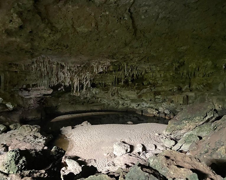
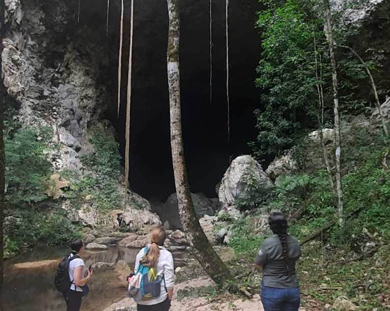
Rio Frio Cave (C)
First identified and excavated by Gregory Mason, a journalist turned anthropologist in 1928 and in 1940. The cave is roughly 240 meters in length from insurgence to resurgence and measures over 40 to 50 meters wide by 30 meters in height. It is a large limestone cave through which the Rio Frio flow underground. The Maya believed that caves, as well as standing bodies of water, were entrances to the underworld known as Xibalba.
Uses of Caves (Thompson, 1959, 1975)
- Sources of drinking water
- Sources of ZUHUY’ HA (virgin water) for religious rites
- Religious rites
- Burials, ossuaries and cremations
- Art galleries
- Ceremonial dumps
- Places of refuge
- Minor sources of minerals
- Bat and/or bird guano may have been extracted from caves for fertilizer (Marachov & Williams, 1992)
Pinol Sands:
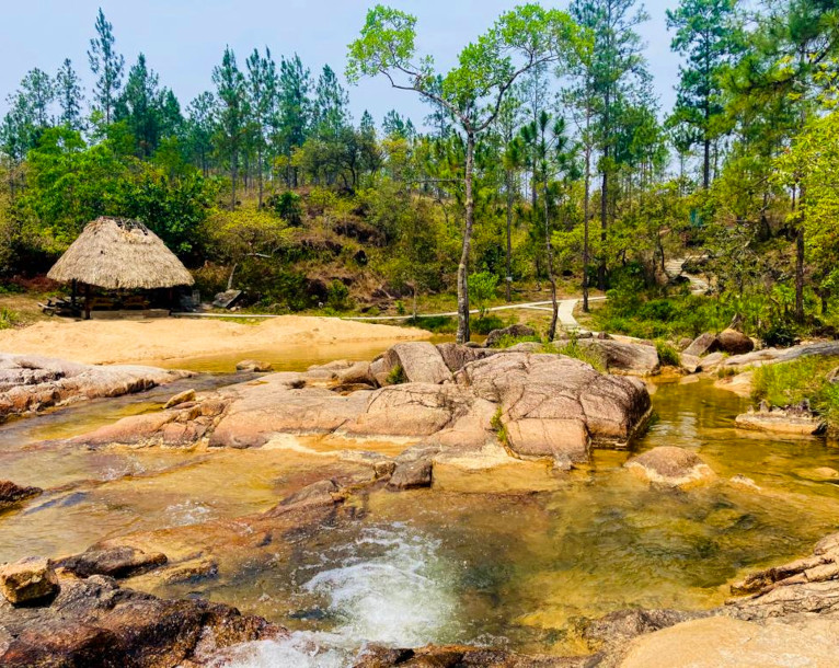
Pinol Creek has three main tributaries originating at an approximate elevation of 560 meters ASL, due east. These tributaries then converge downstream to form one single. This single tributary then travels 1.2 kl as it crosses the A10 road forming the Pinol Sands Pool at an elevation of approximately 398 meters on a granite base. Unlike the Rio Pools these pools are quite shallow and have sandy beach hence its moniker “Pinol Sans”. This makes it a favourite swimming area for children.
The ecosystem type is Tropical evergreen seasonal needle-leaved lowland hill forest with fire induced lowland ferns thickets with mostly tiger ferns. This area was affected in the past by wildlife and is gradually recovering from effects of those fires and as well as from the Southern Pine Beetle (Dendroctonus frontalis) infestation. Currently, the area remains with 8 to 10 meters tall pine specimens as well as emerging seedlings and saplings.
1000 Ft Waterfall
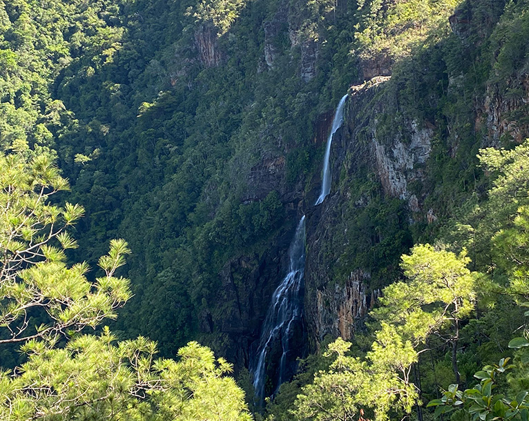
The Thousand Foot Falls Natural Monument (TFFNM), covers 1,290 acres (522.5 ha), and is one of Belize’s smallest protected areas. In 2004, it was designated a natural monument to protect and preserve the unique and scenic geographic landscape surrounding the Thousand Foot Falls.
The natural monument is surrounded by privately owned lands and is located to the northeast of the Mountain Pine Ridge Forest Reserve and encompasses the massive 1,600 foot-high natural waterfall – believed to be the highest waterfall in Central America (Wildtracks, 2011).
Main tourism activities include sightseeing, hiking, camping and birdwatching which attracts many national and international birding groups.

