
Monitoring, Reporting and Verification
Home / Monitoring Reporting and Verification
 The Forest Department’s Measurement, Reporting, and Verification (MRV) Programme is tasked with collecting and analyzing data from the Forestry and Other Land Use (FOLU) Sector, focusing on greenhouse gas emissions and removals from land use and land use change. The data collected contributes to Belize’s international reporting commitments including the National Greenhouse Gas Inventory, National Communication Report, and Biennial Update Report. It also enables Belize to demonstrate progress under measures such as Low Emission Development Strategies, intended Nationally Determined Contributions, and nationally appropriate mitigation actions (NAMAs) for the FOLU sector.
There are two (2) major components of data collection, including:
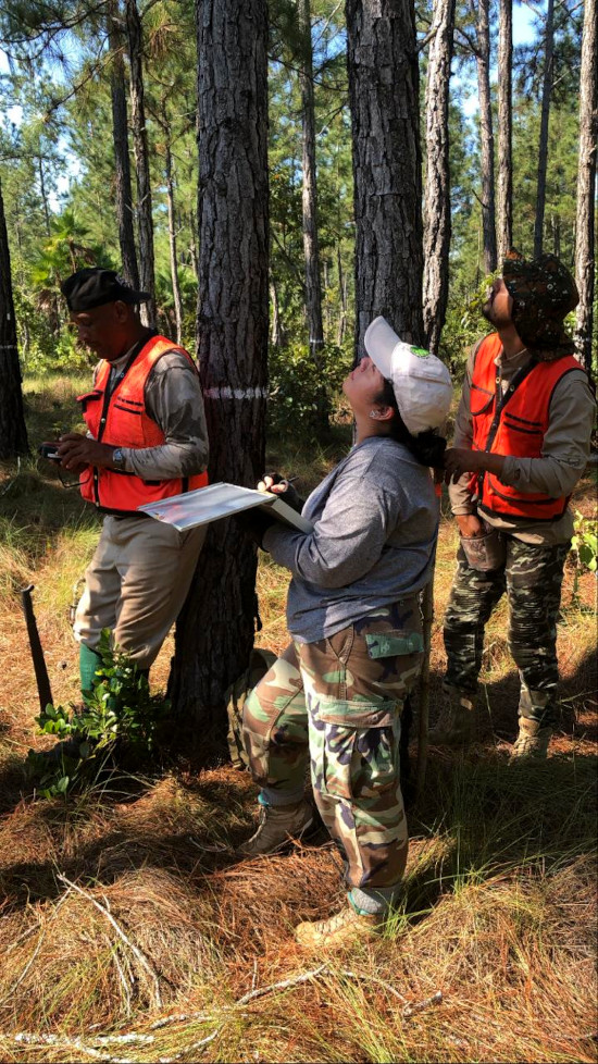
- Ground-based assessments through a network of forest and non-forest Permanent Sample Plots across the country
- Land use and Land use change (LULUC) assessments using remotely sensed data, facilitated through the Collect Earth tool.
These two components jointly make up the National Forest Monitoring System of Belize.
Activities
International Reporting Commitments
-
- REDD+ Technical Annex (2016-2018)
- Completed technical assessment by the UNFCCC
- Completed forest and Other Land Use (FOLU) Sector summary Report (2018-2019)
- Summary report on greenhouse gas emissions and removals from the FOLU sector. Report completed and submitted to the National Climate Change Office for inclusion in Belize’s Fourth National Greenhouse Gas Report to the UNFCCC.
- REDD+ Technical Annex (2016-2018)
Emission Factor Database
-
- Development of the FORMNET-B Emission Factor Database
- The purpose of the database is to calculate emission factors for Belize’s broadleaf, pine, and mangrove forests as well as non-forest ecosystems such as grasslands ( savanna, ferns and thickets, bushes and shrubs). This improves emission and removal estimates reported in the greenhouse gas inventory.
- The database is currently being updated with remeasurement data from the forest and non-forest permanent sample plots
- Development of the FORMNET-B Emission Factor Database
Field Data Collection
-
- PSP Remeasurement (Forest Plots)
- Led the Remeasurement of 5 broadleaf permanent sample plots
- PSP Remeasurement (Forest Plots)
-
- Establishment
- Collaborated with team members from the Environmental Research Institute to establish 2 Mangrove carbon plots in Calabash Caye, Turneffe Atoll Marine Reserve.
- Establishment
-
- PSP Remeasurement (Grassland Plots)
- Led the remeasurement of six (6) lowland savanna plots across Belize.
- Collection of ABG biomass samples to estimate average biomass stocking for savanna ecosystems across Belize.
- PSP Remeasurement (Grassland Plots)
Data Entry and Analysis
-
- Input remeasurement data from forest plots in the FORMNET-B Database for biomass estimation.
- Samples obtained from savanna plots are dried and weighed to estimate above-ground biomass.
Greenhouse Gas Inventory
-
-
- Updating Belize GHGi Tool 2000-2020, providing a robust emissions and removals profile for the country’s FOLU Sector.
-